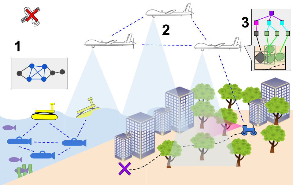
Most drones find their position from satellite signals such as GPS. That works well in open, friendly skies. In a contested area, it is the first thing an adversary will try to take away. GPS-denied navigation is what keeps a drone useful when that happens.
Why satellite navigation is a weak point
Satellite signals reach the ground very weakly, which makes them easy to disrupt. There are three common problems:
- Jamming: a transmitter drowns out the signal, so the drone loses its position fix.
- Spoofing: a false signal makes the drone believe it is somewhere else, so it flies the wrong way with full confidence.
- Blockage: valleys, dense forest, buildings and indoor spaces block or reflect the signal even without an adversary.
A drone that depends entirely on GPS may drift, trigger an emergency landing or be lost. For surveillance and defence work, that is not acceptable.
How a drone navigates without GPS
GPS-denied navigation combines several on-board sensors so the drone can estimate its own movement:
- Visual-inertial odometry: a downward or forward camera tracks features on the ground, and the motion sensors measure acceleration and rotation. Together they estimate how far and in which direction the drone has moved.
- Sensor fusion: data from the IMU, barometer, optical-flow sensor and rangefinder are blended so that no single sensor failure misleads the aircraft.
- Fallback logic: the flight controller detects when satellite data is missing or doesn’t agree with the other sensors, and switches to the on-board estimate automatically.
- Return without a satellite lock: the drone can bring itself home along its recorded path instead of waiting for GPS to return.
What to ask a drone supplier
- What does the drone do the moment GPS is jammed? Does it hold position, continue the mission or land?
- Can it detect spoofing, or only a total loss of signal?
- How far does its position drift over a typical mission without GPS?
- Can it return home without a satellite lock?
- Has it been tested in real jamming conditions, and can they show you?
How we approach it
Our platforms use visual-inertial odometry and sensor fusion across the IMU, barometer, optical flow and rangefinder, with automatic fallback when satellite data is degraded or spoofed. Vision 2.0, our foldable surveillance quadcopter, is built for contested areas. Read more on our GPS-denied navigation capability, or see our guide on how to choose a surveillance drone.